Oficina de Turismo y Juventud
Coastal route Barayo-Navia
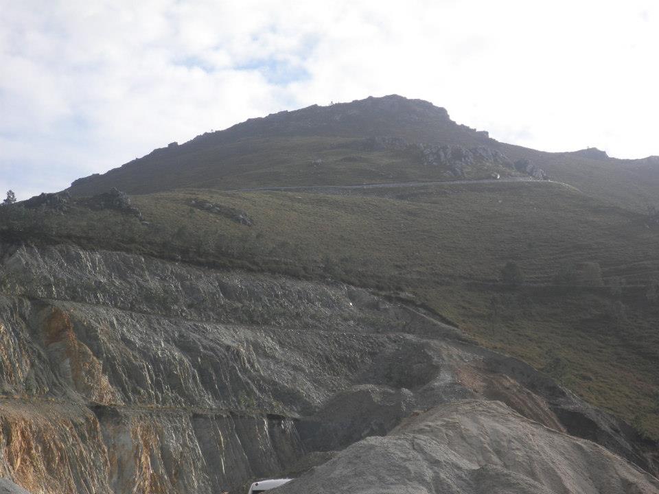
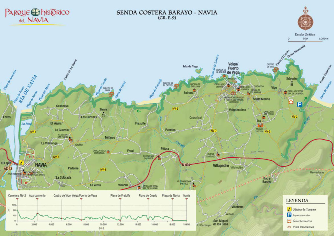
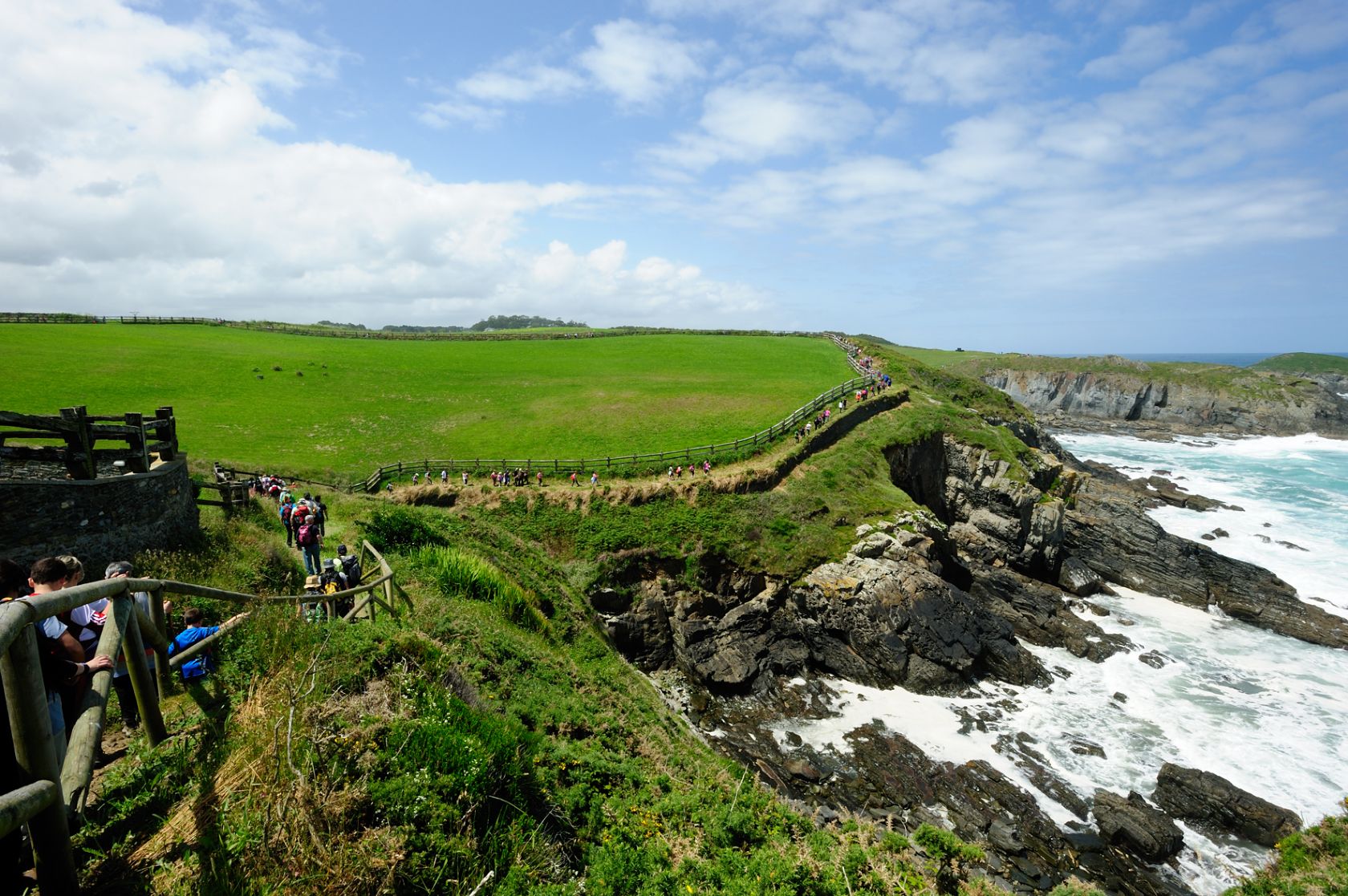
In 1988 this route became very popular when the mountain group Peña Furada inaugurated it. In 1991 the high number of participants set a new official Guiness World Record. Every year in June the mountain group makes this treking route, known as Costa Playas de Navia. It starts on the national road N-634, at kilometer 515.5 at the intersection with the regional road NV-7. Walk on this road and after 400 meters turn right onto an unpaved path. Passing through a beautiful landscape along the Barayo River you will reach the Barayo beach, one of the most valuable natural areas in western Asturias. Along the coast you will enjoy views of cliffs and coves. After 7.8 km you will reach the village Puerto de Vega. This village is not only beautiful but also has a rich historic and cultural heritage. Here you can visit the house where the illustrated writer Jovellanos died, the first customs office in Asturias, the Baroque altarpiece in Santa Marina church. The village's narrow streets, squares and the harbour are worth a visit. Going westwards you will reach La Losera beach and then, at km 9.9 Soirana Island; after crossing the village of Soriana, at km 12.3, you will find Frexulfe beach, which has been declared natural monument and is one of the most popular beaches in the area. The path ends at the place of Andés and its beaches Fabal, Coedo, La Bragada, el Moro, with Navia beach, known as Veiga de Arena, at the very end of the route. This beach, located in a privileged area, offers the visitor numerous facilities. The village of Navia is only one kilometre away, with its river, narrow streets, medieval wall, etc.
St. James Way
The Northern Route Way of St James: passing trough the council of Navia
St. James Way, on the western part of Asturias, is part of the North Way, which starts in Irún and goes through the Basque Country, Cantabria, Asturias and Galicia, until St. James of Compostella.
Town: Navia
Location: Parish and council of Navia
Coordinates: Lat. 43º 32’ 22.04’’ N - Long. 6º 43’ 23.11’’ W
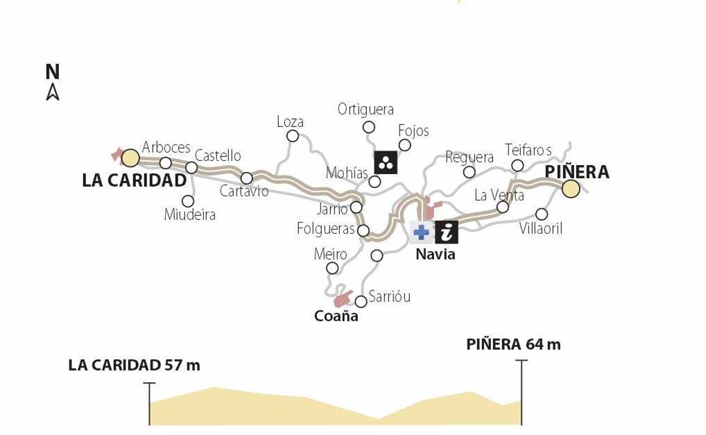
10th Stage: Piñera-La Caridad- 15 Km
Piñera - Navia: 5 Km
Altitude: 15 m
Way: Coastal Route
Province: Asturias
Navia, whose earliest references date back to 1284, soon gained relevance thanks to its fishing sector and salt trade. It underwent an important territorial expansion during the 19th and 20th Centuries.
In its urban architecture you can find traces of its maritime historical past and also vestiges of a medieval wall built in the 16th Century.
Starting in “La Colorada”, the pilgrimage way takes you down to Navia´s town centre across the district of San Roque, where you can find a small 16th Century chapel consecrated to St James.
On the way you can also see the tower of “Nuestra Señora de la Barca”, a church built in 1895 on the foundations of a medieval Gothic church of the 14th Century. It overlooks the Marketplace, formerly known as “El Pañolito”.
On the way you can also find the Town Hall, built in the first half of the 18th Century and first used as a courthouse in 1885, according to the clock inscription.
In Mariano Luiña Street or Tras la Cerca you can find the remains of the Medieval wall and the popular House of Coaña.
The pilgrim hospital in Navia was located at the beginning of San Francisco street. It was consecrated to the Blessed Sacrament and Saint Mary Magdalene. Next to it there was a chapel, which was transformed into a Gothic church in the 14th Century.
Around Navia you can see some interesting examples of the Indiano architectural style*. You will finally leave the town walking through the bridge overlooking the river Navia, which pilgrims had to cross by boat in the past.